
We are on an urban planning streak, publishing two new papers in Environment and Planning B:
- Urban form and COVID-19 cases and deaths in Greater London: An urban morphometric approach, by A. Venerandi, L.M. Aiello, and S. Porta, published in Environment and Planning B
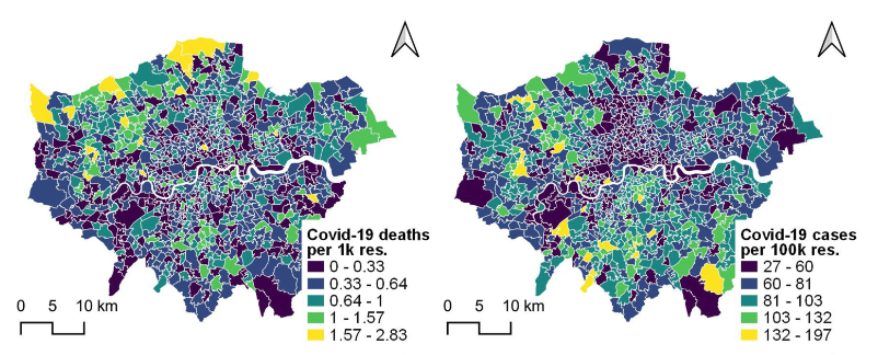
The COVID-19 pandemic generated a considerable debate in relation to urban density. Many urban planners have advocated for rethinking our cities in ways that can decrease built-up density, in order to curb the spreading of future epidemics. In this work, we show that would be a bad idea. We used urban morphometrics to quantify built-up density in Greater London, and studied its relationship with COVID-19 cases and deaths at the level of MSOAs (small neighborhoods with an average population of ~8000). We found that urban density weakly and negatively correlates with both deaths and cases. The picture above (the low-density areas that some think could save us from contagion) shows the typical area in London with highest occurrence of COVID cases. The widespread belief that COVID cases scale with built-up density was supported mostly by city-level studies. The picture changes when comparing different areas within a city, which has been done for the first time in our study. The moral of the story is that built-up density is different from crowding. Let’s keep that in mind before worsening the urban sprawl of our cities. - Data-driven micromobility network planning for demand and safety, by P. Folco, L. Gauvin, M. Tizzoni, and M. Szell, published in Environment and Planning B
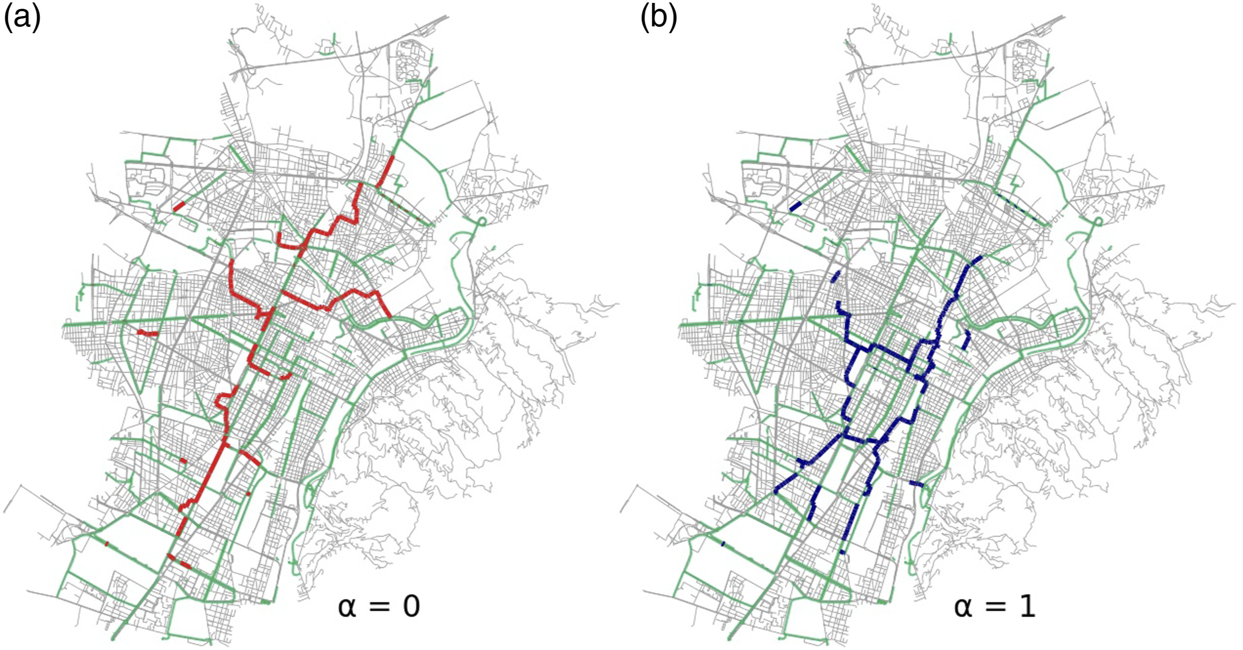
In this paper we study how data of micromobility trips and crashes can shape and automatize infrastructure network planning processes. We introduce a parameter that tunes the focus between demand-based and safety-based development, and investigate systematically this tradeoff for the city of Turin. We find that a full focus on demand or safety generates different network extensions in the short term, with an optimal tradeoff in-between. In the long term, our framework improves overall network quality independent of short-term focus. Thus, we show how a data-driven process can provide urban planners with automated assistance for variable short-term scenario planning while maintaining the long-term goal of a sustainable, city-spanning micromobility network.
See the interactive visualization: http://www.datainterfaces.org/projects/biketracks/#turin